by Rayna Carner
I spent this past summer as well as summer ‘22 working in the High Mountain Hut system under the AMC (Appalachian Mountain Club). The AMC runs 8 huts in the White Mountain National Forest in New Hampshire that provide sleeping quarters, breakfast and dinner, and educational programming for up to 96 guests. All of the huts are not road accessible, and the Hut Croos (traditional spelling) are responsible for packing in food supplies and packing out trash and recycling twice weekly. Last summer when I wasn’t carrying up to 80 pounds on my back, I was giving naturalist programs about watersheds or timescales, playing guitar, and doing funny morning-time skits that loosely explain how guests should fold their blankets, pack out their trash, and practice LNT.
I probably dedicated the most time this summer towards hiking, with the goal of the summer to complete the “hut traverse” (also known as a Hutty T). The hut traverse is a 50 mile and 16,000 foot vertical ultramarathon that starts at Carter Notch Hut to the east, and passes every hut until it reaches Lonesome Lake Hut in the west. The goal is to complete the hike in under 24 hours, which means averaging over 2.5 mph (or under 24 minute miles). Most people start around 2am and finish late evening or nighttime.
The general gist of the route of the hut traverse
The day before my planned Hutty T, I was working breakfast and was assigned the task of recording and reporting the weather report sent over radio from the nearby Mt. Washington Observatory. Having just lived through the a record breakingly wet and cool June and July (I think it was sunny for 5 days during the month of June), I was almost crying tears of joy when I told the guests that that day and the next, the day of my Hutty T, would be in the clear under sunny skies with only the slightest chance of rain. Our information volunteer told me it was the most emotional weather report she had ever seen.
That Sunday I packed down from my hut, met up with two friends who would be hiking alongside me, and hiked the 4.3 miles into Carter Notch Hut with just a running vest and many granola bars. Although I needed the calories, I was super nervous and had difficulty eating the stuffed shells they served for dinner. After hanging for a bit with the Carter croo, I headed to bed around 9:30 pm in anxious anticipation for my 12:45am alarm.
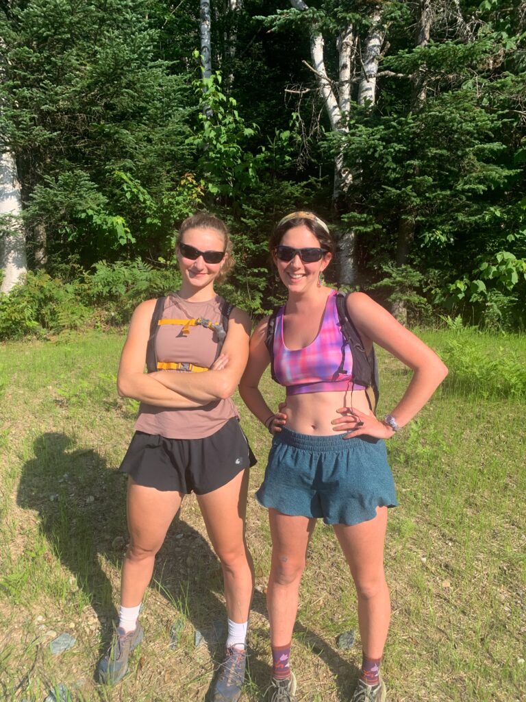
Naomi and I just before hiking into Carter. The sunglasses made us look “fast.”
Tossing and turning but refusing to look at my watch, I finally caved. I peered at my wrist to read 12:44am, my body had known! I woke up my friend Naomi, filled up water, peed one last time, and only stopped to glance at the magnificent starry sky. We were off! In about an hour we were down to the road, maintaining over 3 miles per hour as we ran across the road and into the Great Gulf Wilderness. By 4:40am, we had completed the longest climb of the traverse and emerged above tree line. We could see the sun beginning to rise on the horizon as we followed cairns leading us around Mt. Madison. While the cairns were pretty hard to locate in the dark, I was thankful we weren’t in a cloud as this section of trail commonly is.
By 5am, four hours after starting, we had made it to Madison Springs Hut (10 miles done)! We stole some snacks and left a note for the croo because they weren’t yet awake. I consumed a giant PBJ wrap that was potentially over 600 calories that proceeded to make me nauseous for the next 2 hours.
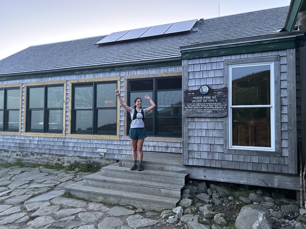
Me very excited that I made it to Madison Hut
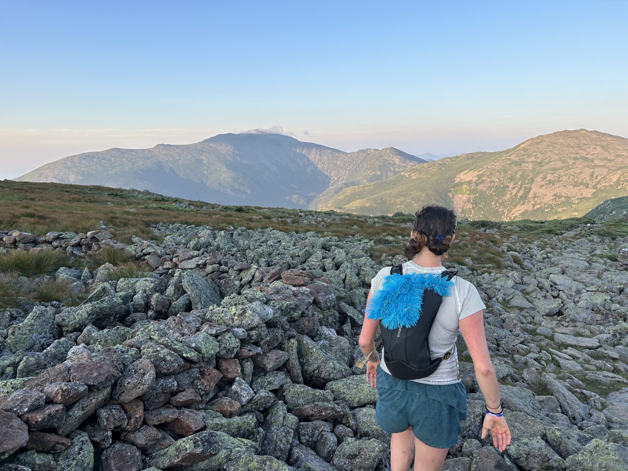
The section between Madison Hut and Lakes of the Clouds Hut was gnarly but beautiful. The elevation wasn’t too crazy, but this section known as the “northern prezzis” (the northern part of the Presidential range) is known for its jagged, loose rocks. For about 7 miles, there was no dirt— only rock piles and stepping stones. Maintaining pace meant hopping from one stone to the next. Too bad the trail was so technical; despite the 360 views, 60 mile visibility, and the gorgeous rising sun over the mountains, it was hard to look up!  Me between Mt. Adams and Mt. Jefferson with a view of Mt. Washington
By 8am, we had rounded the corners of Mt. Jefferson and Washington and were closing in on Lakes of the Clouds Hut at 5,000 feet. It was morning golden hour on the ridge as Naomi and I put on earbuds to listen to a playlist she named “run fast.” We joined the croo just as they were finishing up breakfast service. I stuffed some pancakes in my mouth, drank half a pitcher of tang, and radioed over to my hut that I would be there within 5 hours.
Because the southern prezzis are her specialty, Naomi took the lead running us from Lakes to Mizpah Hut (she had worked at Mizpah in 2019). Behind us on the ridge, we saw a guy that looked like a fellow Hutty T’er (the running vest gave it away). Determined to keep ahead of him, we made it 5 miles to Mizpah in about an hour and 40 minutes. At Mizpah, a friend had made me a personal PBJ while the rest of the croo had made signs for me. So sweet! I was officially halfway.
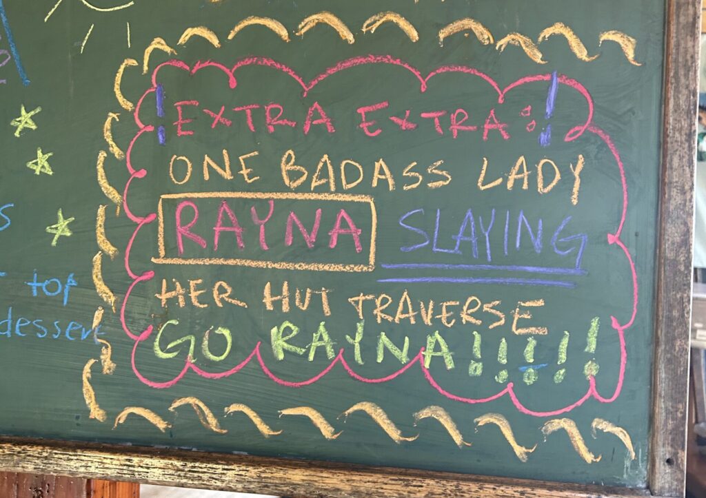
The super sweet note on the blackboard at Mizpah
After 2.7 miles down the Craw Pah (Crawford Path), we hit the Highland Center visitor’s center— the first road we’d crossed in 20 miles! I said bye to Naomi, shook down my vest, popped some ibuprofen for my weakening knees, and within 10 minutes I was off and for the first time in 25 miles by myself. I hiked up and over the ridge of Mt. Tom and descended the A to Z trail to hit Zealand Hut, my home! Reaching the junction of the A to Z trail and the Zealand trail, my pack trail, was kind of surreal. I was in disbelief that I had walked home.
My croo told me I seemed “chiller than they expected.” I changed socks, ate a brown butter chocolate chip cookie and purposefully did not go upstairs where I would be within view of my bed. Elle, my good friend and croo-mate, hiked me up the next 1 mile and 1,000 feet of elevation to Zeacliff. While Zeacliff is a beautiful viewpoint, it was also my “phone booth” because it’s known for its good cell reception. I texted my family and also Emily who would be meeting me at the next hut, Galehead.
Not 2 miles from Zeacliff, I ran out of water. Reliant on my Be Free water filter, I had forgotten there were no water crossings between Zealand and Galehead.
As I ascended South Twin peak, I knew I was dropping pace. A nice hiker had lent me some water, and I finally had enough service to update Emily who was 0.8 miles and over 1,000 feet of elevation away. I reported that I was dehydrated, likely hungry, and it had unfortunately started to thunder.
Emily caught me on the descent to Galehead, fed me some super salty tang, and led me to the hut. Having waited at the hut for the last 3 hours for my arrival, she had informed all of the guests about what she was doing and who she was waiting for. As I walked into the hut, I was greeted by a huge round of applause.
Stuffing tang, hot soup and bread, and brownies in my mouth, I was also standing at the window trying to get reception to look at the weather forecast. The next 8 miles to Greenleaf Hut was super exposed, and not a place where it would be safe to get caught in a thunderstorm. After loading the weather report from the Mt. Washington Observatory, the next few hours showed 50% chance of severe thunderstorms with heavy rain and frequent lightning. My friends were texting me not to cross the ridge.
The other Hutty T’er who we had bumped into earlier on the presidential ridge was also at Galehead and pondering the same decision. After some deliberating, we decided together to play it safe and “semi” bail. We would hike down to the road from Galehead, drive to the shared trailhead of Greenleaf and Lonesome, hike up to Greenleaf, down to the parking lot, and finally to Lonesome. While we wouldn’t be doing the traditional route, we would be hitting all of the huts and doing the same mileage.
From Galehead, me, Emily, and Ty (the other hut traverser) hiked the longest 4.6 miles ever down to the road. I no longer had the energy to run as we hit mile number 40 and the rain poured down on us. We stopped from time to time so Emily could feed me salty tang.
On the 20 minute ride to Lafayette place, the shared trailhead of Greenleaf and Lonesome, I considered bailing on Greenleaf and cutting straight to Lonesome. I felt absolutely horrible and dizzy, and had stiffened up in the car. The thought of bailing made me feel like crying. I was 42 miles in.
Upon arrival at the trailhead, I jumped out of the car and immediately began the ascent to Greenleaf. One more second of deliberation and I would have bailed.
As we maintained 2 mph pace up Old Bridle Path to Greenleaf, I had mentally completed the traverse. There were no more options to bail, and I knew I’d be finishing within 3 hours. When we emerged above tree line, the first stars started to peek out. The headlamp I had turned off 15 hours ago by Mt. Madison was again coming out of my bag…
With strong strides but heavy legs, we burst into Greenleaf Hut. Emily and I hugged the croo and snacked on some leftover dinner rice. While we caught up with everyone, Ty began the descent back down. It was fun to adopt him for a few miles!
The descent down from Greenleaf was definitely the most challenging part of the traverse. It was nighttime, the rocks were slippery from the rain, and my knees and ankles were completely shot. What normally is a 45 minute run took me about 1 hour and 30 minutes. Emily was the best— carrying my running vest, playing music, and helping us find the “croo cut,” the path that cuts off 0.3 miles of trail.
Running into the parking lot, we “ca-cawed” loudly to find the whereabouts of Naomi and Nathan, my boyfriend, who had hiked down from Lonesome to be with me and Emily for the last 1.5 miles. Despite my dwindling energy, I sprinted towards them and gave them both giant bear hugs.
This last section of the traverse, the Lonesome Lake Trail, I knew by heart. Having worked at Lonesome the year prior, I knew every rock and switch back. Surprising myself and my fellow hiking partners, I zipped up the LLT in 35 minutes.
At 11:30pm, I rounded the bog bridges and took the final stairs two at a time to enter into the hut. I thought I would feel emotional, ready to be done hiking, but I was so used to moving I almost forgot what it would be like to stop. I sat down on the floor and peeled off my hiking shoes.
When I got up in 5 minutes to grab a snack and shower, I was almost immobile. While 10 minutes prior I had been hiking quickly on the trail, stopping made me realize my tight calves and blistered feet. I took a quick shower and collapsed into bed.
The next morning, I woke up around 9am to yet another beautiful day. I hobbled into the hut to greet the croo as well as my hiking entourage. While I didn’t yet feel hungry, I certainly was. I couldn’t believe that it was over. But really, I couldn’t believe that I did it.
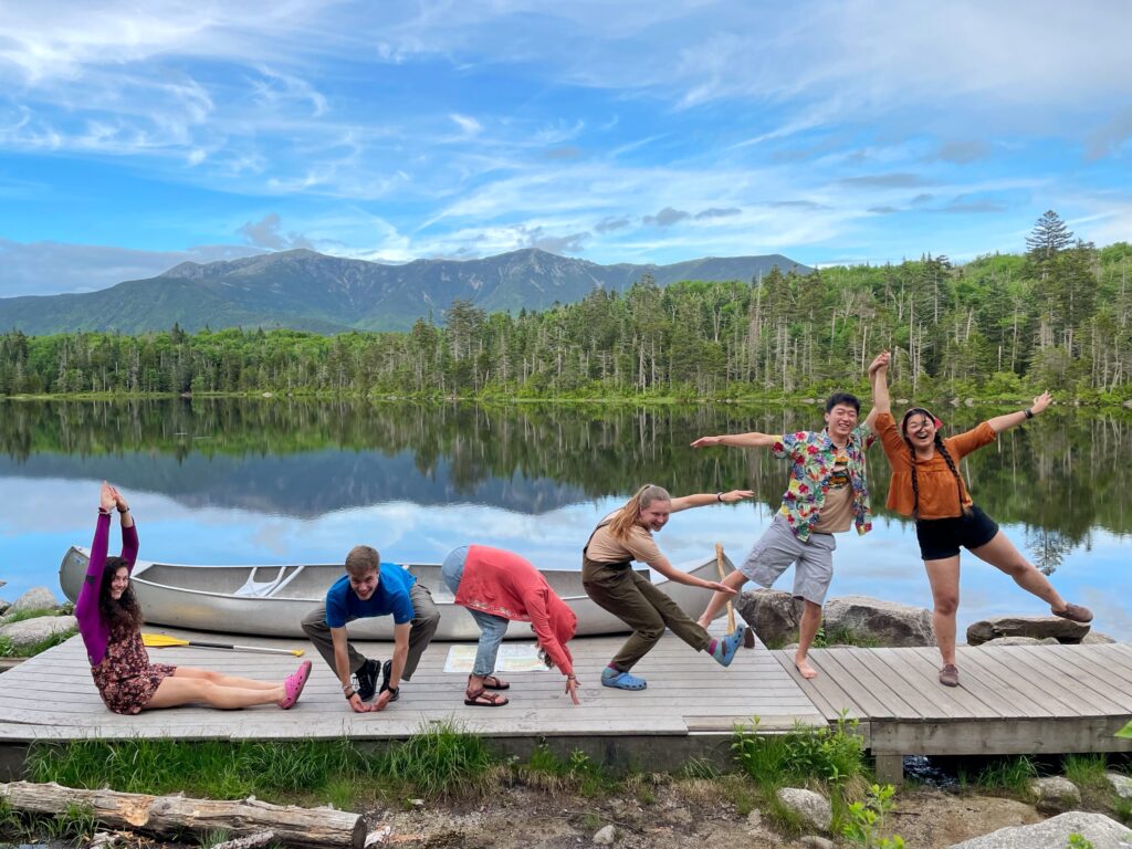
The view from Lonesome— a photo taken of my croo last summer (S ‘21)
About the Author:
Name: Rayna Carner
Major: Earth & Environmental Sciences, Environmental Studies
Grad year: 2024
Hometown: Natick, MA
Favorite outdoor activity: Trailrunning
Favorite camp food: Trail carrots (carrots you eat on trail)
Ideal outdoor trip destination: Northern Presidential Range, White Mountains, NH
What she would bring to a desert island: A frisbee